- Geography
- See also Geology
** Home
|
- Overview New Jersey is ranked 47th of the fifty states that comprise the United States of America in its total area, It measures 8,729 square miles (22,610 km2), of which 14.9% or 1,304 square miles (3,380 km2) is water, and 85.1%, or 7,425 square miles (19,230 km2), is land. At its widest point, the state spans 70 miles (110 km in width and its length is a maximum 130 miles (240 km) from its border with New York to is southeast tip at Cape May. The geographic center of the state is located in Mercer County, 5 miles southeast of Trenton at Longitude: 74° 33.5' West and Latitude: 40° 4.2' North. According to the US Census Bureau, the state's population statistical center--the point where half of New Jersey's residents live to the north and half live to the south as counted in the 2020 US Census--is East Brunswick in Middlesex County. Due to its small size, New Jersey ranks first in population density among the 50 states, with 1,207.83 inhabitants per square mile based on the 2020 Census (459/km2), which reported the state population as 9,288,994. Despite its overall density, the state has only four cities with 100,000 and over in estimated population in 2022: Newark (282,788); Jersey City (256,747); Paterson (144,150); and Elizabeth (131,067). Large areas of the state also remain rural or free from intense development; the Pinelands, for example, which covers some one-fifth of the state, has been protected since 1979 from major development by both state and federal legislation and is the location of extensive pine and cedar forests, the largest freshwater aquifer along the Atlantic coast and farms featuring cranberry and blueberry cultivation. * A Geography of New Jersey: The City in the Garden, Charles Stansfield (2nd edition 1998) - Glacial influences
The geography of New Jersey largely continues to be shaped by the impact of the Ice Age, which occurred during the Wisconsin Glaciation starting roughly 80,000 years ago with glaciers reaching their furthest point approximately 18,000 years ago and not receding until some 7,000 years later. The northern part of the current state was covered by glaciers, which as they advanced pushed rocks and soils ahead, creating what are the mid-sized mountains and hills in the northwest corner along the Delaware River boundaries with New York and Pennsylvania designated by geologists as the Appalachian Ridge and Valley Region. The highlands included the Kittatinny Mountains running parallel to New Jersey's northwestern border, with High Point peak's elevation of 1,803 feet the highest in the state. Atlantic Highlands in Monmouth County is the site of Mount Mitchill, the highest point on the eastern seaboard south of Maine, rising 266 feet (81 m) above sea level. The largest land area, the Atlantic Coastal Plain, covers much of the southern region, characterized by gently rolling hills, pine forests and salt marshes. Closer to the Atlantic coast, the surviving wetlands and salt marshes which have not been filled for development border the Jersey Shore, with the barrier islands in the Atlantic the remnants of long periods over many years of the sea overflowing and then receding to flood the inland soils. The Piedmont, an area only about 20 miles wide which now is the location of the cities of Elizabeth, Patterson, Jersey City, and Newark. Found in this area are the Hudson, Passaic, Ramapo and Raritan rivers; the Passaic was formed when the waters of Lake Passaic, the lake which once covered most of the northeastern section of the state formed by runoff from the melting glaciers, drained as its waters carved a path to the sea. Other remaining signs of the retreating waters are marshes and lagoons, perhaps most visible in the mixed development and wetlands of the Meadowlands in Passaic and Bergen Counties. * Glacial Sediment and the Ice Age in New Jersey, NJ Geological Survey - Rivers, lakes and reservoirs In defining the state's boundaries, the most significant rivers are the Delaware and the Hudson. The Delaware forms the state's entire western border with Pennsylvania, and most of its border with Delaware. The Hudson is the natural border between northeastern New Jersey and New York. Other important rivers include the Great Egg Harbor, Maurice, Mullica, Muscanetcong, and Toms. Lake Hopatcong is the largest freshwater lake in New Jersey, comprising about four square miles or 2,686 acres in area and located in Morris County 30 miles from the Delaware River and 40 miles from Manhattan.Maximum water depths reach to about 58 feet with an average depth of 18 feet. Round Valley Reservoir in Hunterdon County is the largest reservoir. It was formed in 1960 when the New Jersey Water Authority constructed two large dams and flooded a large valley surrounded by Cushetunk Mountain and now covers 2,350 acres with water depths to 180 feet containing 55 billion gallons. 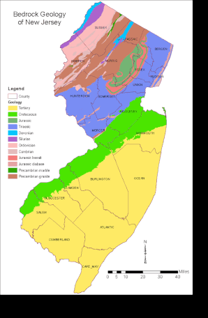
Image: JimIrwin (CC BY SA 2.5), via Wikimedia Commons
|

|
|
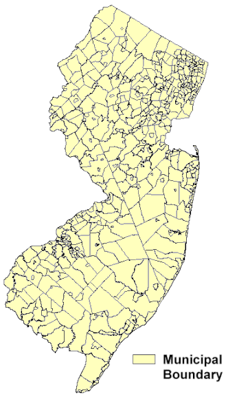
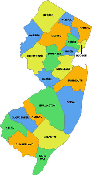
- Governmental boundaries and units New Jersey is divided into 21 county governments and 564 municipalities. Unlike some states, all of the state's area is included under municipal governments, New Jersey has no independent cities, or consolidated city-counties. Municipalities are classified as either City, Township, Town, Borough or Village. The state also has 686 operating school districts in the 2021-22 school year; other special districts include fire districts and authorities and special purpose agencies, typically established for functions such as housing, economic development and transportation.. The state's largest counties in area are Burlington (798.58 square miles); Ocean (450.155); Atlantic (628.78); Sussex (581,413); and Cumberland (483.7). The smallest are Hudson (46.19 square miles); Union (102.85); Essex (126.21); Passaic (184.59); and Camden (221.26). The average land area of a municipality in the state is about 15 square miles.The largest municipalities in area are Vineland (68.42 square miles); Estell Manor (53.32); Millville (42); and Hammonton (28,603). |
|
|
Images: NJ Department of Environmental Protection, onlinemaps.blogspot.com